Cambodia
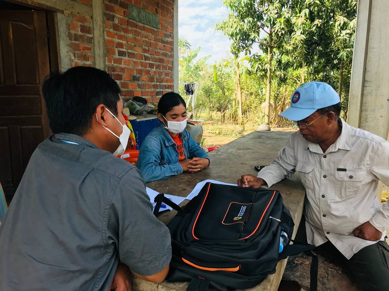
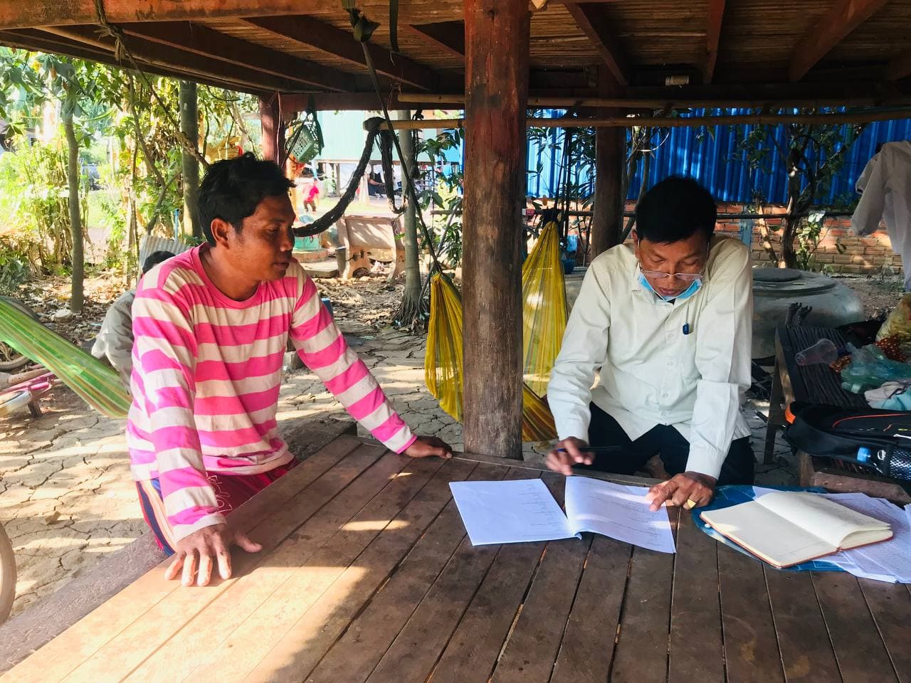
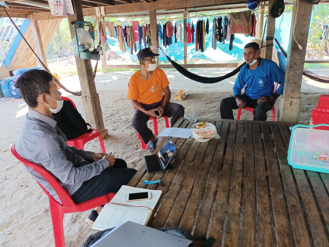
Battambang Province, located in north-western Cambodia
around 291 km from Phnom Penh. Approximately 76% of the
total populations in Battambang province have fully relied
on agricultural productions, especially the rice production.
Battambang province has divided land areas into three main
areas such: i) Upland: is an area of fruit and vegetable
plantation in the west, ii) Plain land or Rice fields, and
iii) Lowland: Tonle Sap area, located east of Battambang.
The total area is 1,162,200 hectares, of which 415,200
hectares are for agricultural land areas (35.72%) and
divided into 3 parts such; i) Floating rice land areas are
comprised of 32,600 hectares; ii) Rice land areas are
comprised of 282,500 hectares; and iii) Crop land areas are
comprised of 100,100 hectares. In addition to agricultural
cultivated land areas, the 38.22% is the mountain areas,
12.54% is the flooded forests, and 3.65% is the rivers,
lakes, and reservoirs.
AFSIS Secretariat has been providing time series data by Database, as well as reports on supply and demand information and production forecasts for five main crops. These reports are known as the Agricultural Commodity Outlook (ACO) and Early Warning Information (EWI). Initially, the activities focused only rice-related data, but over time, the scope expanded to include all five major crops in alignment with the AFSIS database. Under the implementation of the SAFER project, the AFSIS Focal Points had discussed on the appropriate agricultural commodity to be added as a new target commodity apart from five main crops. Following deliberations, the meeting concluded that “Laying Hens” would be the new commodity added to the AFSIS Database, as well as the ACO and EWI reports. The AFSIS Secretariat developed a guidebook outlines the data collection process and provides clear definitions and descriptions of the necessary data items to support the integration of this new commodity into AFSIS’s reporting mechanisms.
Sub-indicator 1:
Farm output value per hectare
Sub-indicator 2:
Net farm income
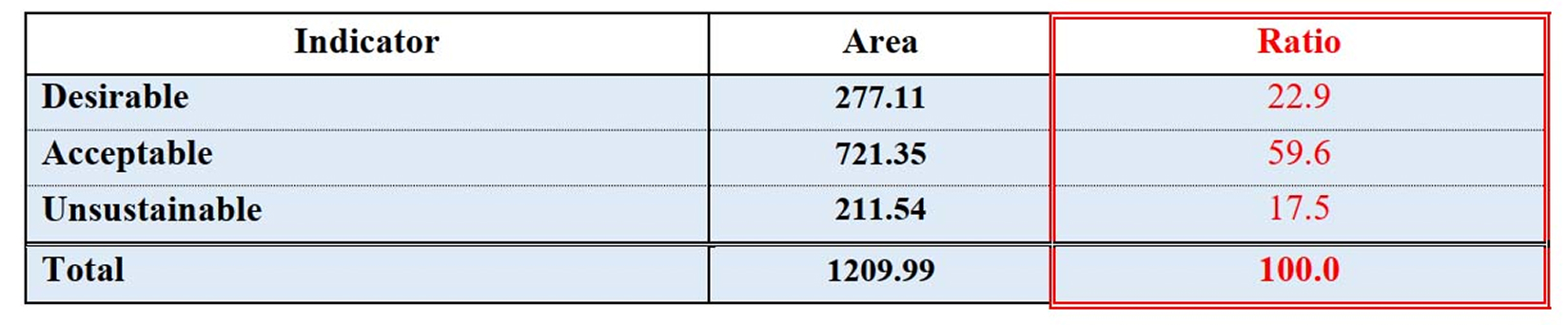
Sub-indicator 3:
Risk mitigation mechanisms
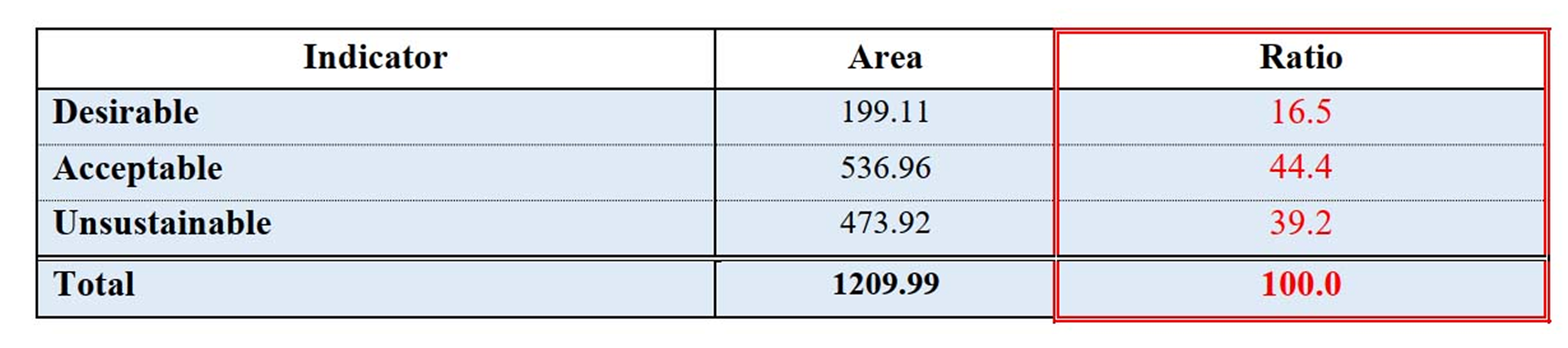
Sub-indicator 4:
Prevalence of soil degradation
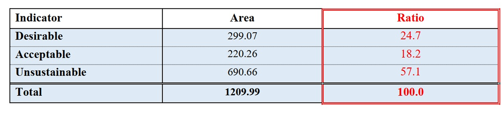
Sub-indicator 5:
Variation in water availability
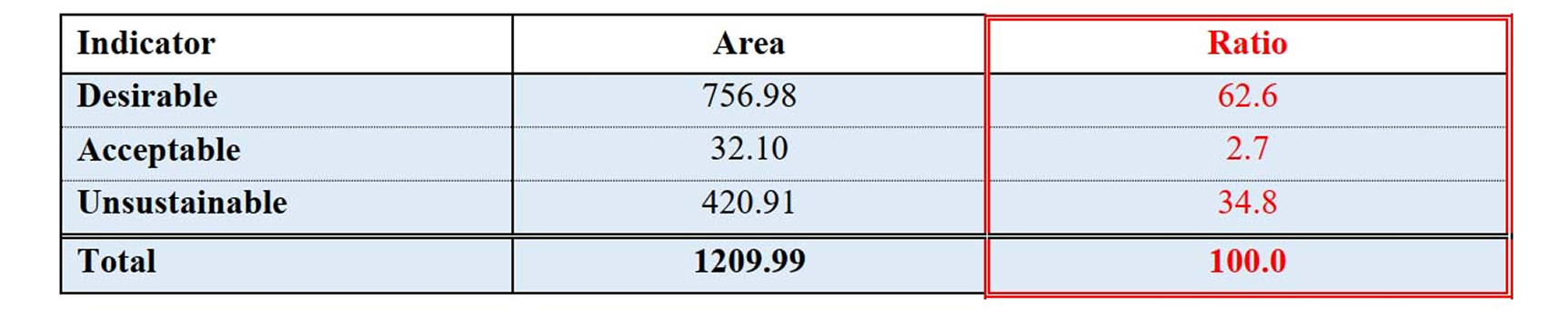
Sub-indicator 6:
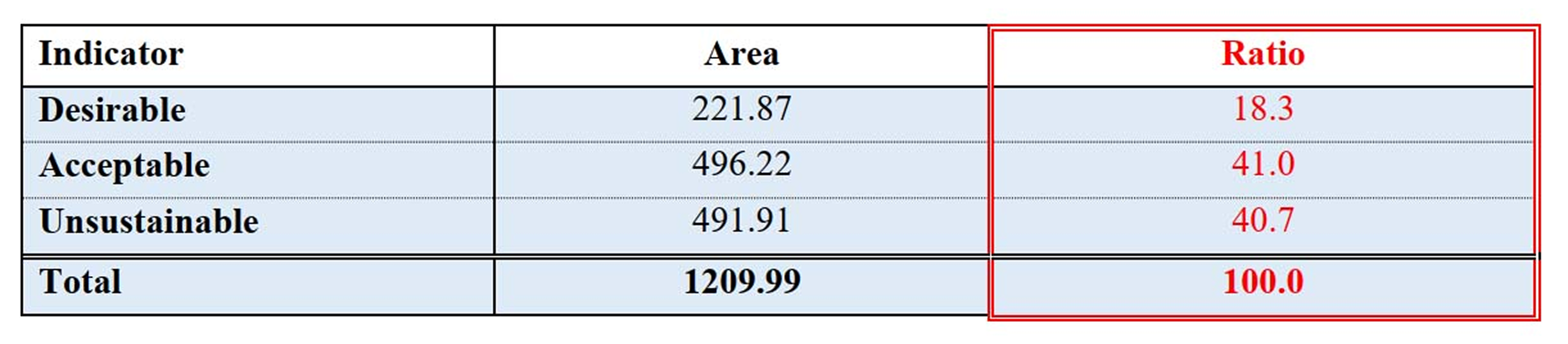
Management of fertilizers
Sub-indicator 7:
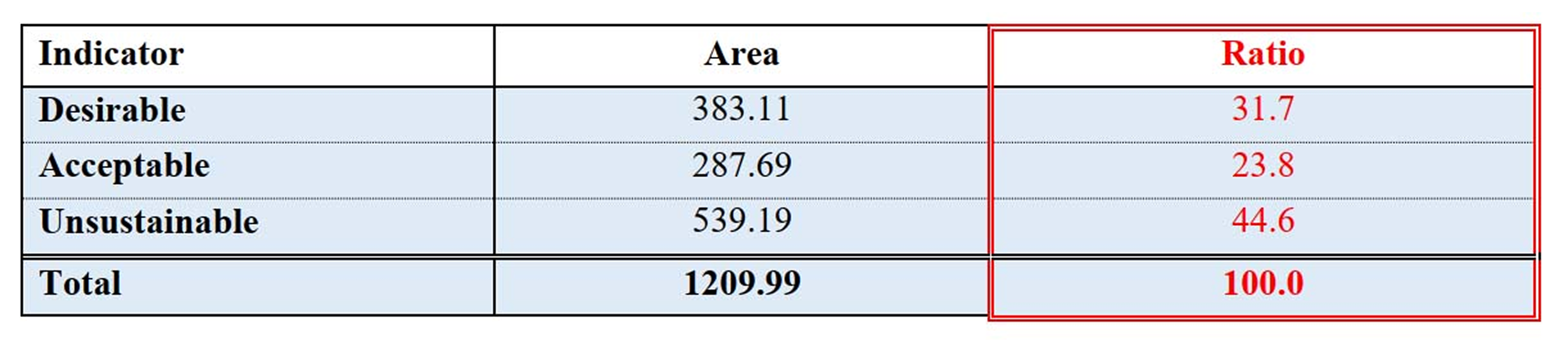
Management of pesticides
Sub-indicator 8:
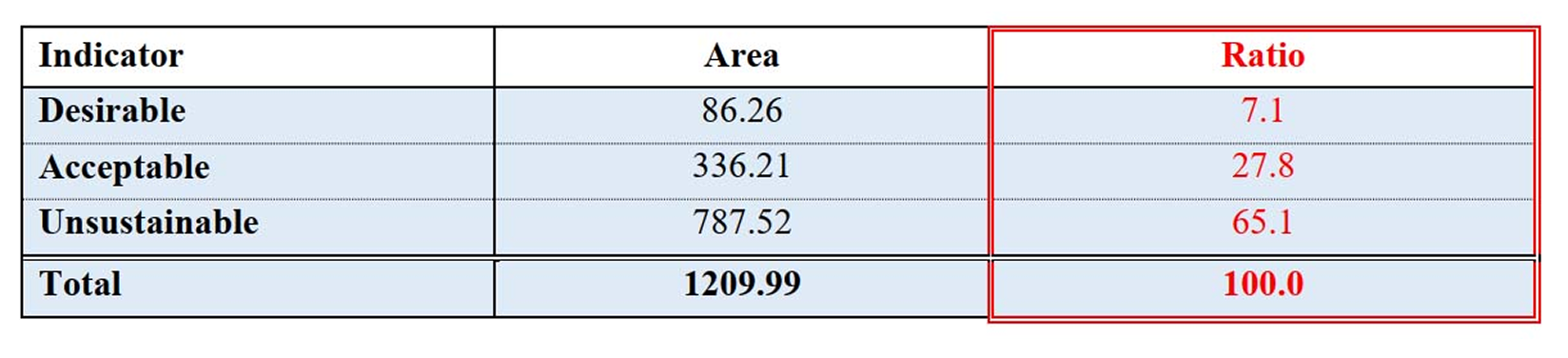
Use of biodiversity-supportive practices
Sub-indicator 9:
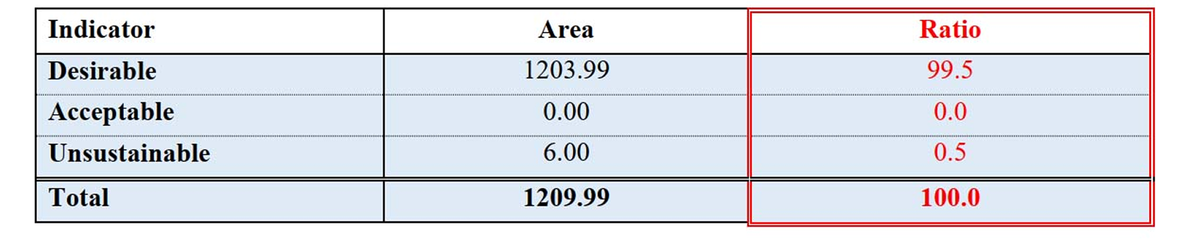
Wage rate in agriculture
Sub-indicator 10:
Food insecurity experience scale (FIES)
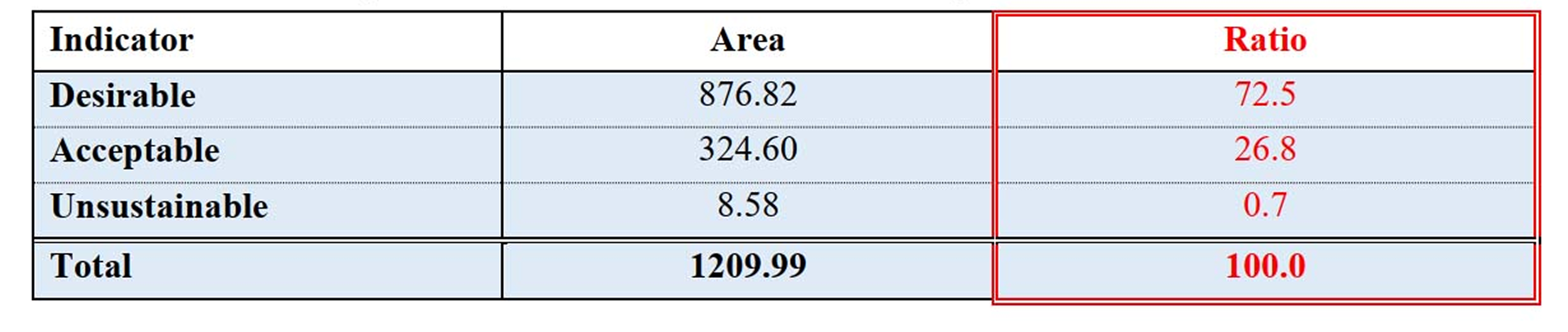
Sub-indicator 11:
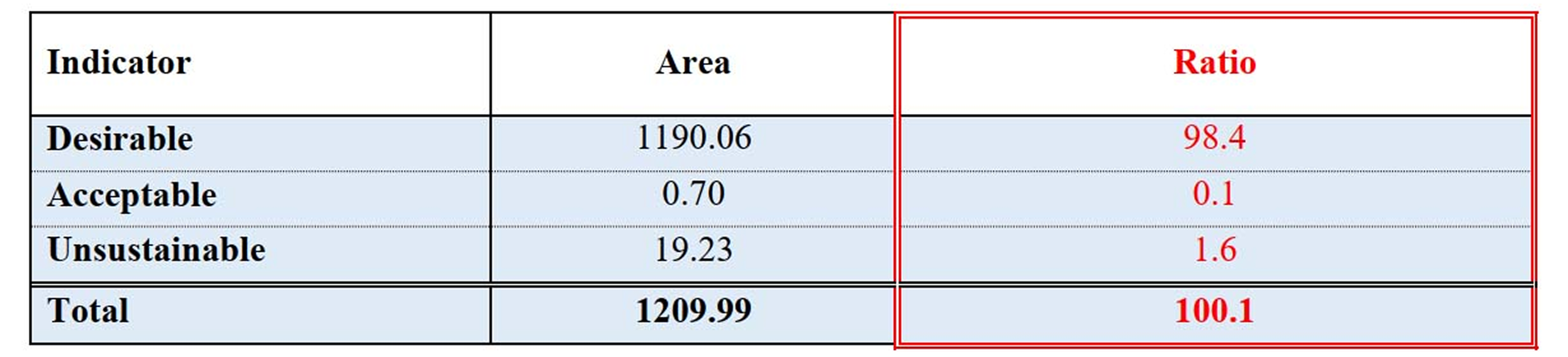
Secure tenure rights to land
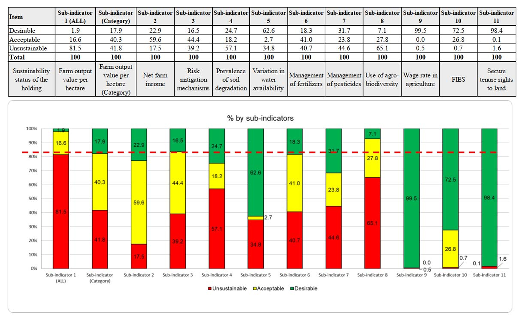
SDG 2.4.1 Dashboard
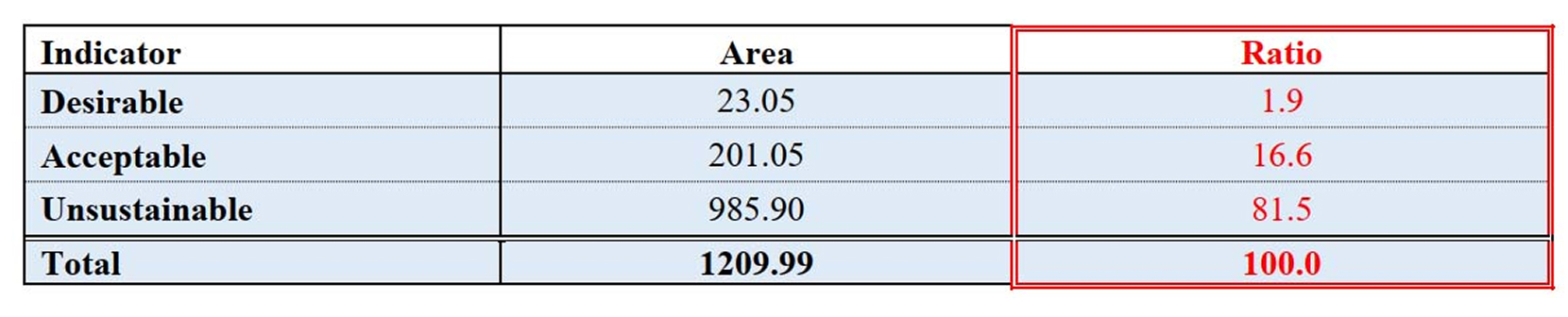
The sub-indicator with the highest level of unsustainability is Farm Output Value per Hectare with 81.5%. This result was largely influenced by the fact that many main crop farmers with medium and large areas of agricultural land had low farm output value per hectare. This may be due to a lack of management and lower productivity as the size of the farm increases. Also, during Covid-19, the cost of agricultural inputs was high (fertilizer, pesticide, transportation operations and etc.) which affected to soil degradation and technical practices are still limited.
- The availability of an appropriate sampling frame is
crucial for conducting validated surveys. Basically,
because the sampling frame captures the relationship
between the target population and the unit of
observation. This pilot project although used existed
sampling frame, ostensibly there is unavailable sample
frame for the non-household sector. - It would be more effective if we develop the
appropriate policy-making in a small scale first and
expand it in a bigger scale to accumulate a track record
of effectiveness. The survey found it very difficult for
respondents to understand the point that they had to
give a monetary value for their self-consumption of what
they produced. - If the government encourage farmers to be more aware
of health risks from pesticides, biological pest control
and using drones for crop fertilization may be
effective. - Cambodia may need crop cutting survey on permanent
crop (rubber, cassava, cashew, nut, mango and etc.) and
livestock (Pigs, buffalos, cow, chickens, duck, and
etc..) to support SDG 2.4.1 - For questionnaire, the best practices would be (1)
the multiple- choice questions would need to be adjusted
to suit Cambodia circumstances (2) the questionnaire
should be simplified and comprehendible so that it will
not be a burden for both numerators and selected
respondents.
SAS-PSA Project in Cambodia A pilot study on SDG indicator 2.4.1 in Battambang Province, Cambodia
Download PDF